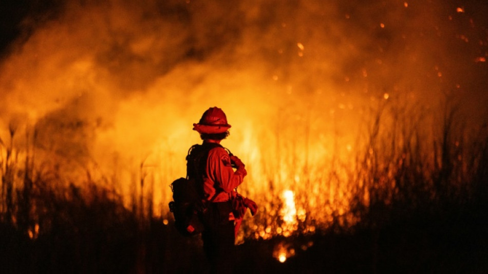
Slew of satellite projects aims to head off future wildfires / Photo: ETIENNE LAURENT - AFP/File
 Eli Crane Defeats Jonathan Nez in Tight Arizona Congressional Race

 Sherilyn Smith Encourages Women to Embrace Scars as Symbols of Resilience

 Belgium Signs Contract for 20 Rheinmetall Skyranger Air Defence Systems

 Four Nines Gold Intersects 67 Metres at 1.78 g/t Gold, Reinforing Emerging Gold Corridor at Hayden Hill

 InterContinental Hotels Group PLC Announces Transaction in Own Shares - November 10

 Spectrocell Strengthens Product Discovery and Customer Engagement with Bioz Badges
 Apex Extends Trinity Zone in West Step-out Drilling With 2.52% REO Over 223.3 m and 2.49% REO Over 123.3 m at Rift

 Zomedica Announces "Third Friday at Four" Webinar on November 20, 2026: The People Behind Zomedica - Seven Guiding Principles in Action, and Q3 Financial Results
 Geek+ Unveils 24/7 Warehouse Autonomy Plan to Advance Self-Optimizing, Around-the-Clock Operation
 China Explores a New Pathway for Medical AI: Bridging R&D Innovation and Clinical Adoption
 Aztec Drills 70.1 Meters of 0.80 g/t AuEq (0.49 g/t Au and 16.85 g/t Ag) from Surface in TR26-54 at the Tombstone Project, Arizona
 Zeb Nickel Commences Diamond Drilling at the Zeb Nickel Project
 Electrovaya to Participate in Upcoming Investor Conferences
INEO Invited to 15th Annual ROTH Technology Conference in New York
 Nextech3D.ai to Report Fiscal Second Quarter 2027 Financial Results and Host Investor Webinar on November 19, 2026 at 4:30 PM ET

 Sterling Metals Announces Fully Allocated Private Placement of Units, Flow-Through Shares and Charity Flow-Through Units

 Greene Concepts Highlights Groundwater Resources and Commercial Opportunities

 Allstar Health Brands Confirms MLS NEXT Expansion Bid to Anchor a Permanent Training Structure and a Professional Pathway

 Securitas Healthcare Introduces a New Era of RTLS Built for the Future of Healthcare Operations

 Cardiff Lexington To Report Third Quarter 2026 Financial Results and Host Conference Call on Monday, November 16, 2026
ByNext Joins the Bilt Neighborhood: Reaching More Customers by Integrating Its Technology with Bilt Neighborhood OS

 Peraso to Showcase DUNE 60 GHz Wireless Platform at Africa Tech Festival 2026

 SMX Advances Development of its Scientific Intelligence, an AI-Powered Platform Intended to Create a Comprehensive Codex for Chemical Agents, Additives and Supplements
 Kalm with Kava and Pū'iwa Farms Hawai'i Bring Fresh Frozen Hawaiian Kava to Market
 Berwyn Group Launches BerwynAPI, Bringing Real-Time Death Confirmation to a Broad Variety of Industries Including Financial Services, Insurance and Healthcare

As Los Angeles firefighters battle remaining hotspots more than a week into deadly blazes, scientists and engineers hope growing availability of satellite data will help in the future.
Tech-focused groups are launching new orbiters as space launches get cheaper, while machine learning techniques will sift the torrent of information, fitting it into a wider picture of fire risk in a changing environment.
Satellites "can detect from space areas that are dry and prone to wildfire outbreaks.... actively flaming and smouldering fires, as well as burnt areas and smoke and trace gas emissions. We can learn from all these types of elements," said Clement Albergel, head of actionable climate information at the European Space Agency.
Different satellites have different roles depending on their orbit and sensor payload.
Low Earth orbit (LEO) is generally less than 1,000 kilometres (620 miles) above the surface -- compared with up to 14 km for an airliner.
Satellites here offer high-resolution ground images, but see any given point only briefly as they sweep around the planet.
Geostationary satellites orbit at around 36,000 km, remaining over the same area on the Earth's surface -- allowing for continuous observation but usually at much lower resolution.
As climate change brings growing numbers of wildfires encroaching on human-inhabited areas, that resolution can be crucial.
In Los Angeles, "there are satellite observations, but it's very hard to determine -- is it my house that's on fire? Where exactly is this?," said WKID Solutions' Natasha Stavros, a wildfire expert who has also worked at NASA.
"Some people stay because they don't really understand... that's where this idea (that) we need more observations available comes from."
- 'More fire than we know' -
Brian Collins, director of Colorado-based nonprofit Earth Fire Alliance, plans a new low-orbit satellite "constellation" to complement existing resources.
It will sport a sensor with a resolution of five metres (16 feet), much finer than ESA's current Sentinel-2 satellites that can see objects only 10 metres wide.
This means "we're going to learn very quickly that there is more fire on the Earth than we know about today, we're going to find very small fires," Collins predicted.
EFA aims to launch four satellites by the end of 2026, the first in just a few weeks, at a total cost of $53 million.
That figure is a "drop in the bucket" against the property damage and lives lost to wildfires, said Genevieve Biggs of the Gordon and Betty Moore Foundation, which has financially supported EFA's satellite project.
It would take the whole planned swarm of 55, costing a total $400 million, to reach Collins' aim of imaging every point on Earth at least once every 20 minutes.
Dozens of satellites in orbit could "both detect and track fires... at a cadence that allows decisions to be made on the ground," Collins said.
Less grandiose efforts include Germany-based OroraTech, which on Tuesday launched the first of at least 14 shoebox-sized FOREST-3 "nanosatellites".
The system will "deliver ultra-fast wildfire alerts and high-quality thermal data," chief executive Martin Langer said in a statement.
The Moore foundation is also backing a geostationary satellite project dubbed FUEGO.
- 'Last mile' -
Additional data from all these new satellites would be "fantastic", ESA's Albergel said, but the large volume of information can prove problematic.
ESA's Sentinel-2 alone sends down one terabyte of data -- the storage capacity of a modern high-end laptop -- every single day.
Finding fire signs in such reams of data "is an excellent machine learning, artificial intelligence problem... the 'needle in the haystack'," Collins said.
The data could ultimately help both predict new fire outbreaks and their progression, he added.
Looking ahead, Stavros said there was no "silver bullet" technology for wildfires.
"It's all of them working together" that will help emergency responders and slash risk from fire, Stavros said.
Beyond high-tech detection and tracking, the Moore Foundation's wildfire programme also focuses on making communities more resilient and managing fire-prone ecosystems -- which can include "increasing ecologically beneficial fire while decreasing detrimental fire", Briggs said.
O.M.Souza--AMWN